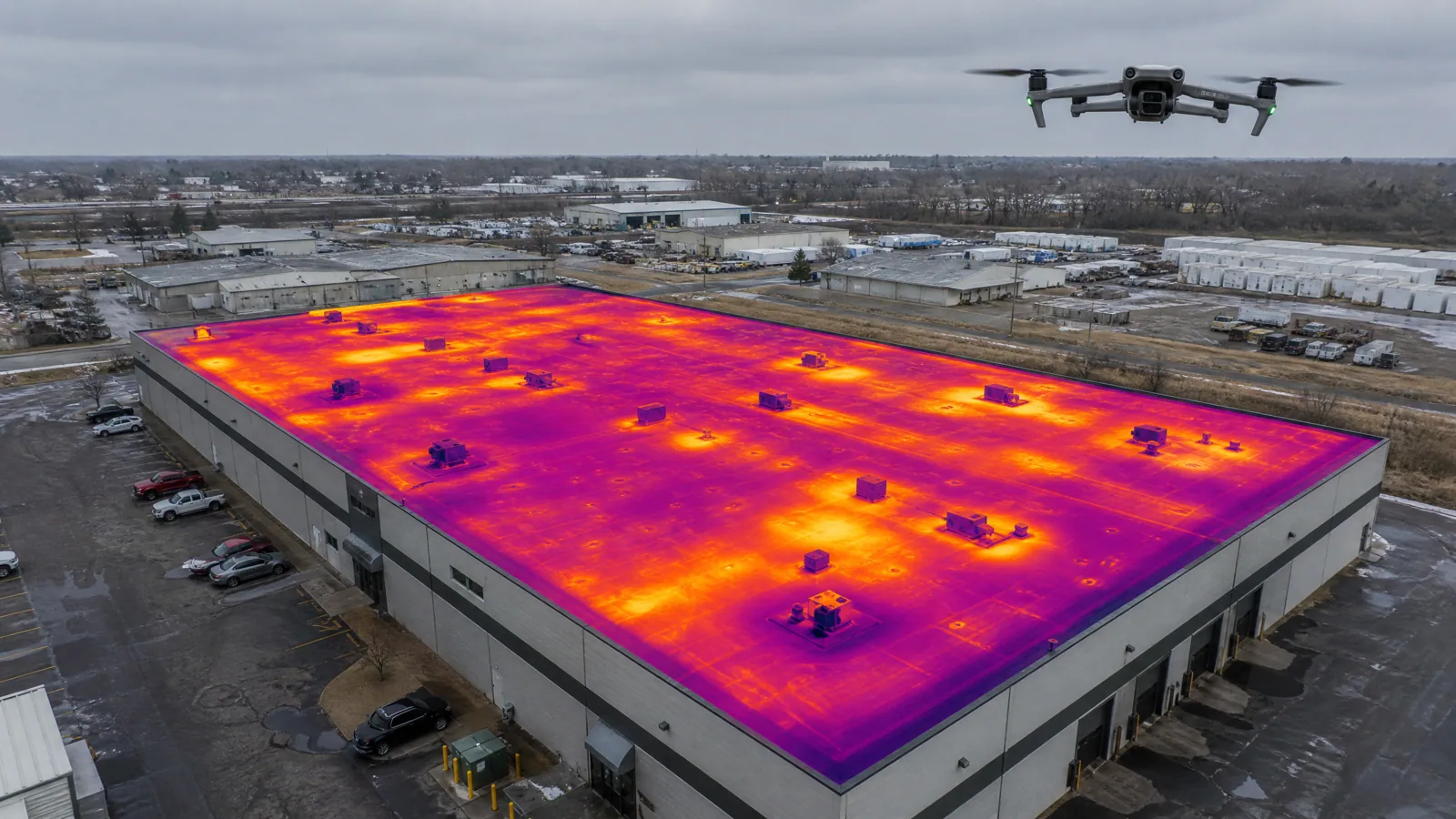
A drone does not slip on ice. That alone makes it a useful tool in Flagstaff, AZ, where a roof can sit under ice from the first hard freeze to the spring thaw and stay unsafe to walk. Commercial Roofing Flagstaff flies commercial roofs to photograph every section, map drainage and record snow patterns, then follows up on foot where the images raise questions. The drone is a scout. It sees the whole roof in minutes and tells us where to spend the hands-on time.
It does not replace the walk. It makes the walk faster and safer.
Some roofs are better seen from above. Large flat roofs with limited access. Steep metal roofs where a fall is a real risk. Roofs coated in frost or a thin skin of ice. Buildings where a walk would disrupt tenants. Roofs with many units and obstacles that make a ground-level survey slow.
The drone gives a complete view in a short flight. We capture overlapping images of the entire roof, then review them for ponding, torn membrane, displaced flashing, missing fasteners, rust and debris. We zoom in on anything suspicious and mark it for a hands-on check.
For owners with several buildings, a drone pass can rank the roofs by visible condition. That tells you where to send the crew first.
Snow on a flat roof tells a story before anyone climbs up. After a storm, the shape of the snow on a roof is evidence. Deep drifts behind parapets and around rooftop units mark where load concentrates. Bare patches can show where heat escapes. Slumped or sagging snow can mark a deflected deck.
A drone can record that pattern in minutes, without anyone stepping on the roof. We photograph the snow cover, then repeat the flight after the melt. Comparing the two shows how water moved and where it collected. That is useful when planning drains and crickets.
If images suggest the structure is under stress, we say so and recommend an engineer. We do not send crews onto a roof that looks overloaded.
You receive an organized set of images tied to a roof map. Each finding has a location, a photo and a recommendation. We mark areas that need a hands-on check, areas of ponding, damaged flashing, loose coping and signs of past repairs.
The set becomes a baseline. When the same roof is flown a year later, you can compare condition side by side. That is useful for capital planning, warranty claims and sale negotiations. A dated aerial set also gives a lender or an insurer a record to file.
We keep the format simple. A report that arrives as a hundred unlabeled photos is not useful. Ours arrives with labels and a ranked list. Our roof condition reports use the same layout when a lender or an insurer needs formal documentation.
Ponding leaves marks. After a rain or a melt, discolored rings, algae, dirt lines and standing water show where the roof holds water. From the air, those marks line up into a drainage map. Low spots, blocked drains and flat areas that need a cricket stand out at once.
July and August storms drop their share of the year's moisture in short, hard bursts, and the drains take the whole test at once. We fly after a storm to catch standing water before it dries. A roof that still holds water two days after rain has a slope or drain problem, and the images show where. We pair that with a ground-level check of each drain and scupper.
Snow and thaw tell a similar story. Meltwater trails across the membrane toward drains, and where those trails stop, water pools. A pair of flights, one before winter and one after, builds a clear picture of how the roof sheds water.
One flight is a snapshot. Two flights a year is a trend. We recommend repeating the flight each fall and spring on roofs with known problems, large fields or active repair plans. Changes show up quickly: a crack that has widened, a patch that has lifted, a section of coping that has shifted.
The trend helps capital planning. If a roof is losing condition fast, you can move the budget forward. If it is stable, you can wait. Either way, you are working from a record rather than an impression.
Keep every set. When a warranty claim, insurance claim or sale comes up, a series of dated images carries weight that a single photo does not.
A camera sees the surface. It does not see wet insulation, soft deck or a seam that looks closed but is not bonded. For those, we use moisture meters, infrared and probes. An infrared moisture survey is the right tool for hidden water, and a full commercial roof inspection checks the seams, drains and details a camera cannot confirm.
Wind and weather also limit flights. Gusts, rain and low cloud can ground a drone. In Flagstaff, afternoon thunderstorms are common in July and August, so we fly in the morning. In winter, cold reduces battery time and we plan shorter flights.
Airspace matters too. Flagstaff Pulliam Airport lies about 5 miles south of the city, and flights near an airport follow federal rules. We plan around them and tell you if a site needs extra coordination.
Along I-40 in Bellemont, Camp Navajo, a former ordnance depot now run by the Arizona Army National Guard as an industrial park, munitions storage site and training site, sits in the community. Aerial surveys on any military property follow base access rules and escort requirements, which we plan for at booking.
In the airport technology park, the planned buildings are meant for research, manufacturing and office use. A drone baseline of each new roof records its as-built state. Downtown, in the Railroad Addition, historic commercial buildings can be tight to walk, and an aerial pass shows the roofs from a safe angle.
Usually not on its own. It shows the roof's surface condition and layout, which helps with scope and access. Pricing a replacement needs moisture data, deck condition and core samples. We combine the aerial images with an infrared scan and a hands-on check before we write a number.
Yes, and the snow pattern is part of the record. We fly in calm, dry weather. Wind and falling snow ground us. After the melt, we fly again to compare. Both flights go into the report.
Federal airspace rules apply near Flagstaff Pulliam Airport, which sits about 5 miles south of the city. We check the airspace for each site and request authorization when needed. We tell you early if a property needs it, since approval can take time.
Raw images are available the same day. The labeled roof map and findings follow after review. For a large roof, the review takes longer because we examine each image. We tell you the delivery date when we book the flight.
Rarely. A drone is quiet compared with a crew on the roof. We notify the property manager, avoid flying over people and follow site rules. Where a property has privacy or security concerns, we adjust the flight path.
Browse the services, roof systems and building types we work with across Flagstaff and nearby Arizona communities.
A walk of the roof with photos, findings and a written scope.
Active leaks, storm damage and blocked drains get a fast response.
Roofing across Flagstaff and nearby Arizona communities.